

Itoshima, a gem of a peninsula stretching approximately 17 km east to west and 10 km north to south, is not only compact in size but also rich in natural beauty. You might already be familiar with its picturesque locales such as Keya no Oto, Niginohama, Futamigaura, and Shiraito Falls, all of which are popular stopovers for those on scenic drives and cycling tours. However, it’s also a fantastic place for those who love to walk in the countryside and hike trails.
The gentle rise of Itoshima’s low mountains, peaking at elevations below 1,000 meters, offers accessible adventures for all—whether you’re a novice hiker, a family with kids, or simply seeking a tranquil escape in nature. Each trail is a choice of its own, whether you’re aiming for panoramic summits or indulging in the simplicity of a nature hike.
Highlights include mountains that reward climbers with stunning views after just 15 minutes of ascent, routes that promise a fulfilling round trip within three hours from the nearest JR train stations, and trails that weave through multiple mountains and passes, tailoring each journey to your personal stamina, skill, and available time.
Basking in a mild climate, Itoshima’s mountains invite year-round exploration, with the autumn season painting the landscape in vibrant hues for an even more spectacular experience.
In this feature, we present select hiking trails chosen for their signature Itoshima vistas and the continuous embrace of beautiful scenery. These trails are especially inviting from autumn to winter, a time free from the discomforts of heat and insects.
Before setting out on a hike, even if it’s a low mountain, it’s crucial to prepare and ensure your safety thoroughly. Check your physical fitness, and ensure you have the appropriate attire and sturdy hiking boots. Plan your route carefully and have a clear itinerary. By taking these steps, you can ensure a safe and enjoyable climb.
Nijodake and Medake in Itoshima
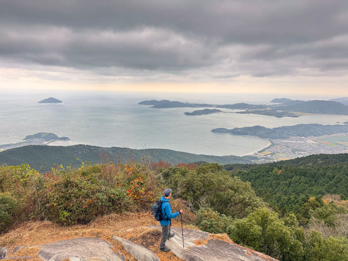
This popular course traverses Nijodake and Medake at the western end of the Sefuri mountain range. At the summit area of Nijodake, which is 711 meters high, there are some of the best scenic spots in Itoshima, making it a great destination for your first Itoshima mountain walk. It’s also possible to walk there from JR stations (Chikuzen-Fukae or Dainyu).
• Date of coverage: November 12, 2023
• Distance: approx. 11 km
• Time: approx. 5 hours
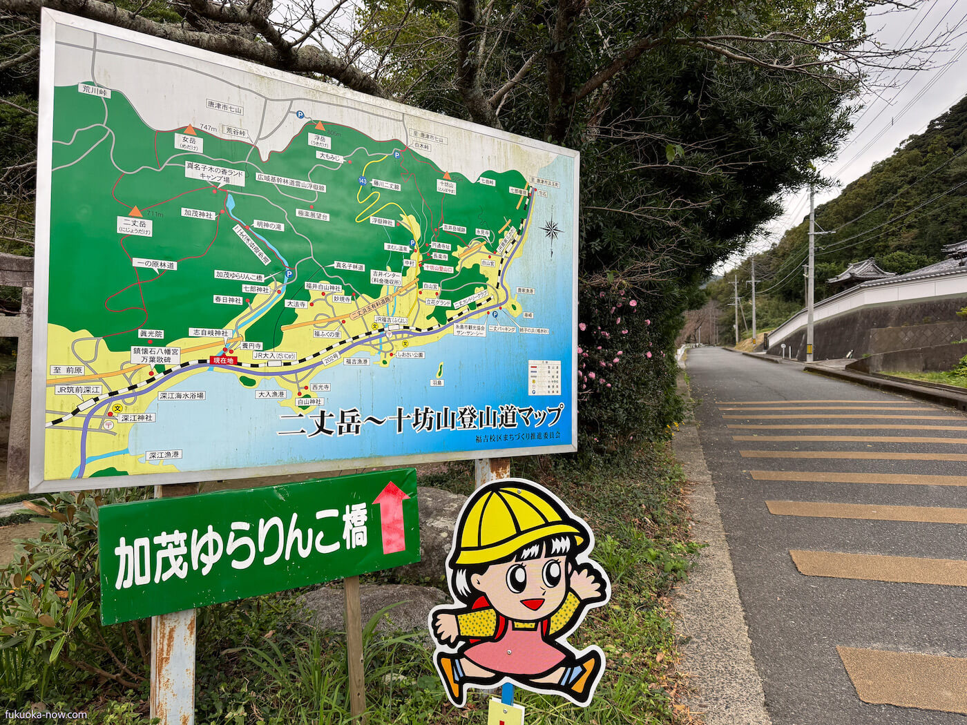
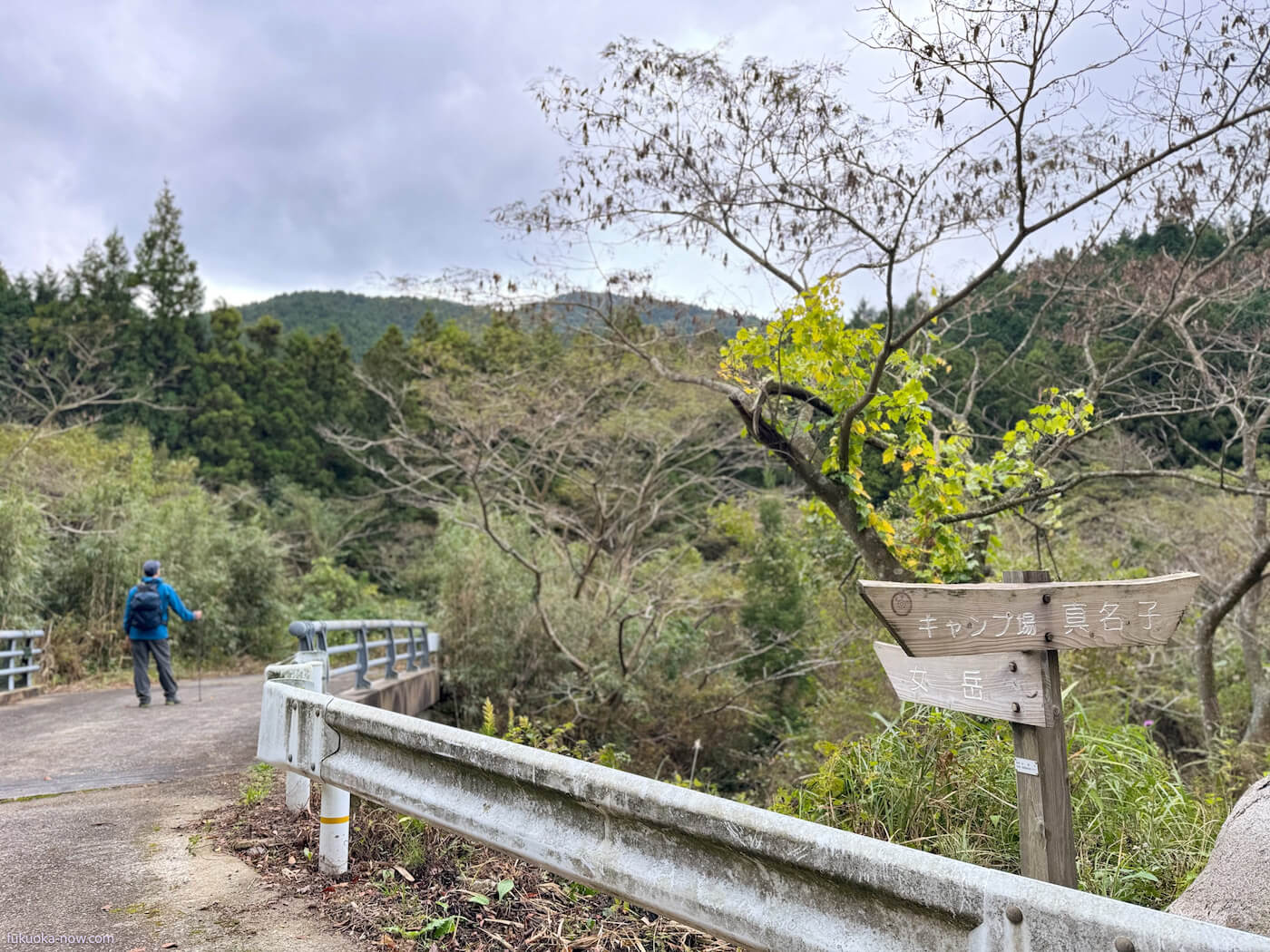
Starting Point 1: Kamo Yurarinko Bridge
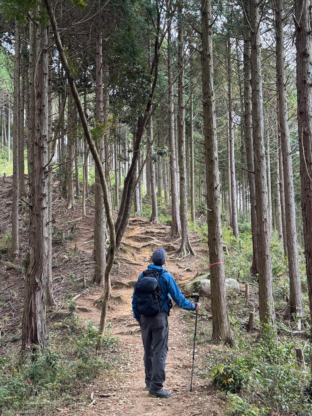
There are several routes to climb Nijodake, but beginners are recommended to start from the “Kamo Yurarinko Bridge.” It is about a 50-minute walk from JR Dainyu Station to the entrance of the hiking trail to Nijodake and Medake. There is a free parking lot (40 cars) and toilets. From here, you can head towards Kamo Shrine or Manago Kinoka Land via the Nijo Valley promenade. If you are traveling by car, there is “Nijodake Manago Parking Lot” further up from Kamo Yurarinko Bridge. There is also a free parking lot and toilets here, and starting from this point can shorten the one-way trip by about an hour.
Starting Point 2: Manago Trailhead (Nijodake Manago Parking Lot)
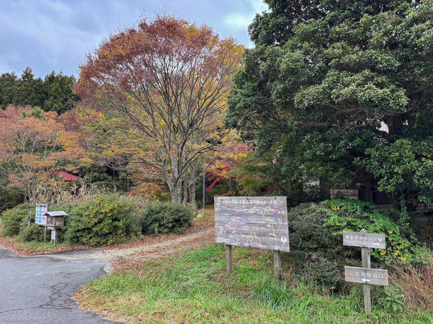
Embrace the serenity of the forest as you depart from the Manago Trailhead. The towering trees guide your gaze skyward and your feet to the summit, less than an hour away.
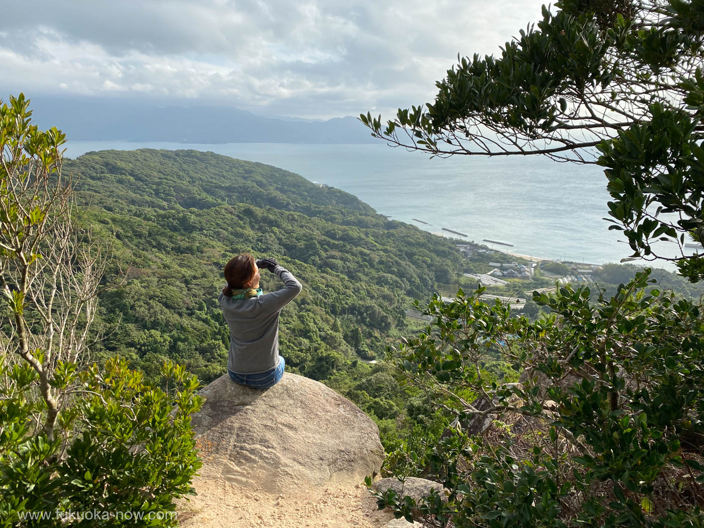
Reach the pinnacle where ancient ruins and colossal rocks stand as a testament to history’s reach. Revel in the grandeur of the view and your accomplishment.
Should time or energy be limited, Nijodake offers a satisfying conclusion to your journey, inviting a return along the familiar trail. The summit provides plenty of space to sit and some shelter from the wind, making it an ideal spot to rehydrate or refuel with snacks.
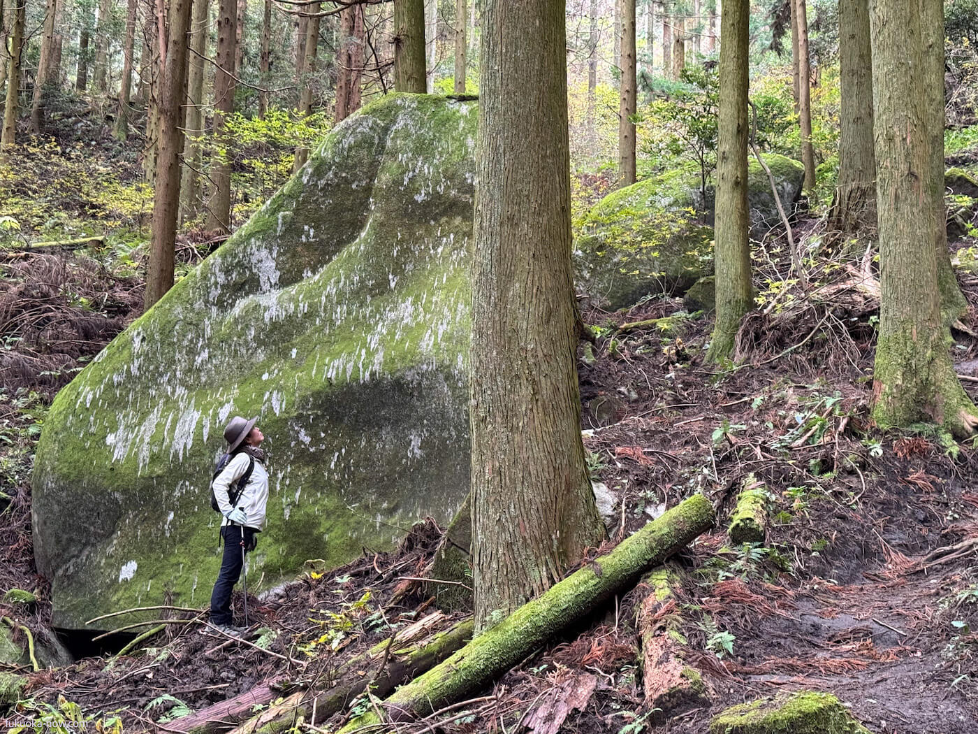
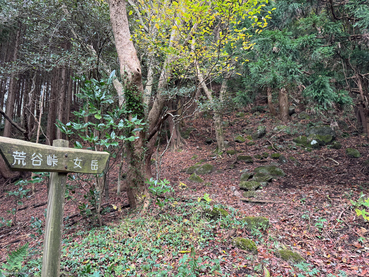
An hour’s trek from Nijodake leads to another peak, Medake. Navigate towards the Manago Kinoka Land Campsite, with clear signage to ensure a confident path.
The summit of Medake may be modest, but the views of Nijodake and the sea peeking through the trees are anything but. Plan to summit by noon, and the mountaintop becomes your dining room with nature as your host.
Afterward, the descent via Aratani Pass presents a steeper challenge, but the ascent path remains an option for a leisurely descent.
This route rewards with impressive scenery, marking this passage as a highlight.
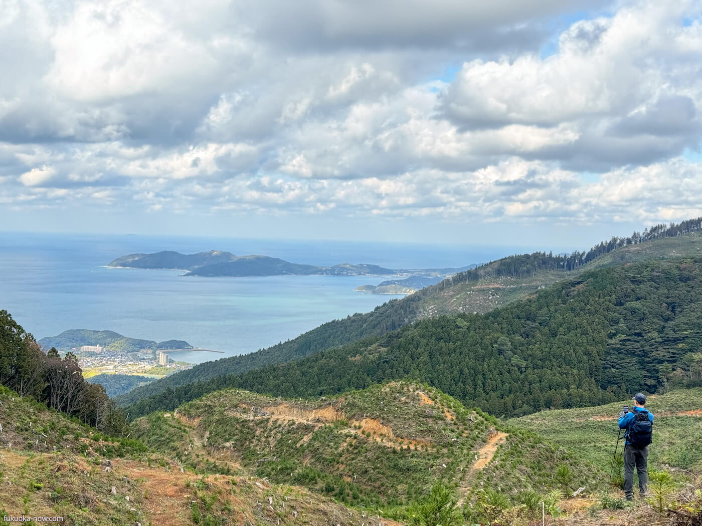
The sight of the Genkai Sea from the mountainside, adorned with youthful cedars, creates moments of profound beauty. The journey back is a descent into reflection, as the landscape offers a display of seasonal artistry, especially the golden ginkgoes in autumn.
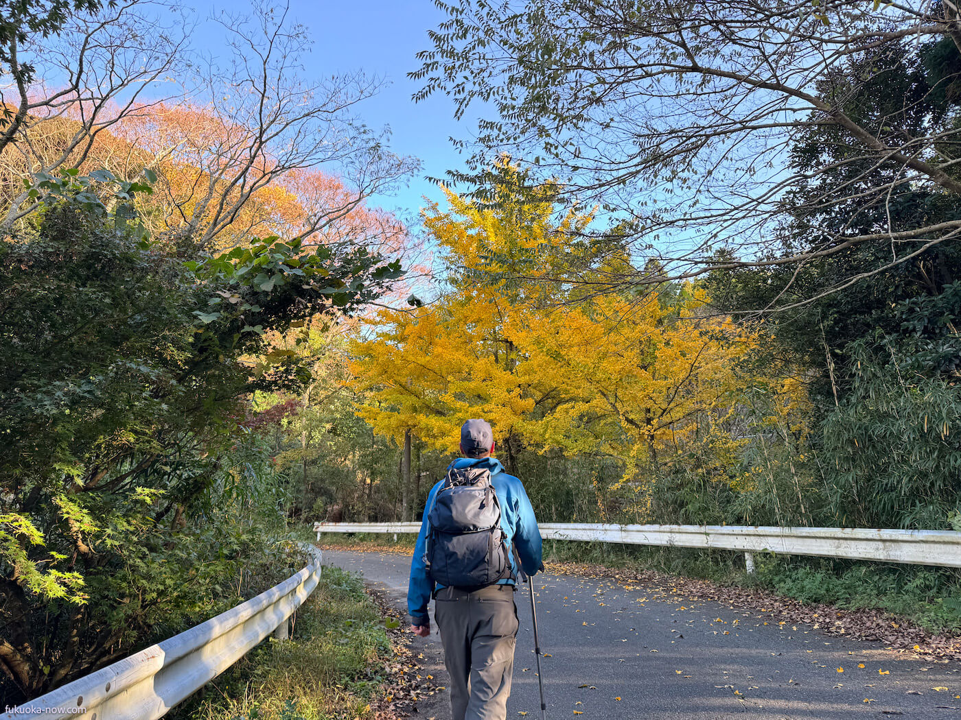
Returning to where you started, Itoshima’s gentle climbs offer an array of picturesque moments, each step a dialogue with the landscape. The touch of the trees, the grounding of the earth beneath your feet—it’s a journey that leaves you enveloped in a comforting sense of fatigue and fulfillment.
Mountains in Itoshima
Below is a selection of well-maintained mountains, ideal for both novice and experienced climbers. The ‘Mountain Walking in Itoshima’ maps, which detail 12 of these mountains, are available for free. You can pick up your copy at Itoshima City Tourism Association (tourist information) offices near JR Chikuzen-Maebaru Station, at city halls, or download the PDF for a digital companion on your ascent. Please note that while the maps are only available in Japanese, they are very well made, and we highly recommend getting one. They are also available at some trailheads, but not all.
Itoshima Hiking Maps: Four Key Areas
1. Mt. Iwara, Raizan, Hagane (井原山・雷山・羽金山)
2. Mt. Kaya, Tateishi, Hiyama, Chinyama (可也山・立石山・火山・鎮山
)
3. Mt. Takasu (高祖山)
4. Mt. Nijodake, Medake, Ukidake, Tonbo (二丈岳・女岳・浮嶽・十坊山)
Mt. Iwara (Iwarayama)
Elevation: 982m
Iwarayama is the highest peak in Itoshima. It boasts numerous valleys and waterfalls, offering a range of activities from hiking to traversing across to Mt. Raizan, or Mt. Hagane, elsewhere and stream climbing. Additionally, its rich vegetation is a major attraction, earning it the nickname “Mountain of Flowers.”
Mt. Raizan
Elevation: 955m
Raizan, a mountain held sacred through the ages, boasts a summit that opens up to a grand view of the Sefuri mountain range and Hakata Bay. It’s a place where history, spirituality, and natural beauty converge, offering a contemplative escape for the modern hiker.
Mt. Hagane (Haganeyama)
Elevation: 900m
A top Haganeyama, within the boundaries of a standard radio wave transmission station, the summit enforces a quietude with restrictions on food and drink. The intercom at the entrance is your gateway to a peak that combines technology with tranquility.
Mt. Kaya (Kayasan)
Elevation: 365m
Kayasan, endearingly nicknamed “Itoshima Fuji” or “Little Fuji” by locals, resembles the iconic shape of Japan’s renowned peak. A rewarding one-hour climb culminates with a spectacular view from the summit, where landmarks like Keya no Oto and Nokonoshima seem within reach.
Mt. Tateishi (Tateishiyama)
Elevation: 209m
Ideal for beginners, Tateishiyama’s trails are welcoming, with sparse tree cover allowing uninterrupted views of the encompassing scenery. This hill invites hikers to enjoy the journey as much as the destination.
Mt. Hiyama (Hiyama)
Elevation: 244m
From the summit’s observatory, Hiyama presents a breathtaking view of Niginohama’s bow-shaped coastline against the backdrop of the Genkai Sea. This low mountain’s vista is a favorite among photographers and contemplative hikers alike.
Mt. Chinyama
Elevation: 186m
The summit of Chinyama crowns Himeshima, an island shaped by the forces of nature and time. A brief ferry ride from Kishi Port and a subsequent 3-minute walk lead to a trailhead that promises an adventure rich with coastal beauty and island mystery.
Mt. Takasu (Takasuyama)
Elevation: 416m
Step back in time with a historical hike to the ruins of Ito Castle and Takasuyama Castle. Takasuyama not only offers a physical ascent but also an elevation in historical knowledge, with each step revealing stories from the 8th and 13th centuries. The Takasu Shrine, located on the western slopes of Mount Takasu, was designated as an Important Cultural Property of the country in 2023.
Mt. Nijodake
Elevation: 711m
The expansive summit of Nijodake, strewn with ancient castle ruins and interlocking boulders, presents a breathtaking panorama of Itoshima’s azure seascape. It’s a premier spot for those seeking a picturesque conclusion to their climb.
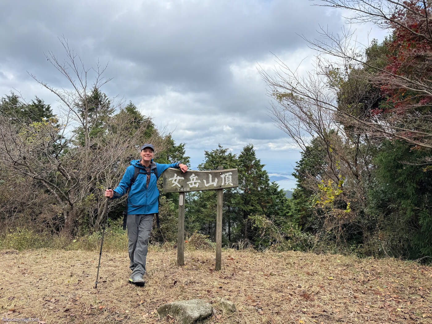
Mt. Medake
Elevation: 748m
Amidst the lush greenery of Medake, a clearing near the summit grants a peek at Nijodake’s silhouette. The ascent is marked by the presence of large, stoic rocks that stand as natural monuments to the mountain’s enduring presence.
Mt. Ukidake
Elevation: 805m
Ukidake is revered as a sacred peak, with its shrine sitting solemnly at the summit. The northern view subtly opens up to reveal the island of Iki, offering a serene space for reflection and connection with the divine.
Mt. Tonbo (Tonboyama)
Elevation: 535m
Situated on the western edge of the Sefuri mountain range, Tonboyama’s summit is a natural amphitheater offering expansive views of the Genkai Sea. The summit’s Bouzu Rock is a vantage point that provides a full-circle experience of Itoshima’s panoramic splendor.
Essential Information for Hikers
Mountain Climbing Plan Submission: A Proactive Step for Safety
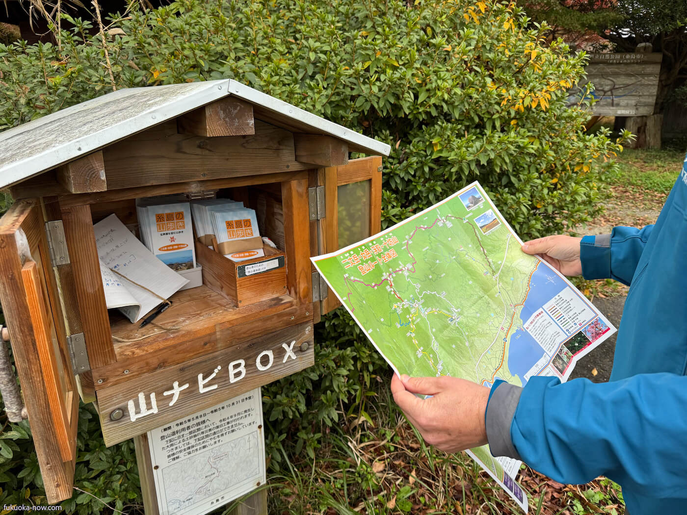
Before embarking on a climb in Fukuoka Prefecture, consider submitting an electronic mountain climbing plan. While not compulsory, the Fukuoka Prefectural Police advocate for this practice. It’s a proactive measure that allows climbers to self-assess their preparedness for safe climbing. Moreover, in the unlikely event of an emergency, this plan is invaluable for facilitating efficient search and rescue operations by the authorities. The website is in Japanese only. Signs with QR codes can be found at some trailheads. Alternatively, many sign into a notebook four at the “Yama Navi” boxes at some trailheads. Link: https://www.police.pref.fukuoka.jp/tiiki/tiiki/M_report.html
YAMAP Climbing App: Your Virtual Guide
Stay oriented with the YAMAP Climbing App, your go-to digital companion in areas where cell service doesn’t reach. This essential app for mountain enthusiasts boasts detailed maps and route information from all over the country, enhanced by the shared experiences of the climbing community. For peace of mind during your ascent, download the map of your chosen mountain directly to your smartphone. YAMAP ensures you are well-informed and your path is clear. The app is highly functional in its free mode, and there’s also a premium paid version for those who climb frequently and require additional features. The app includes an English language option, which is very helpful, though please note that not all content and interface elements are available in English. Given its popularity, it’s an excellent resource for checking the most recent and current trail conditions.