


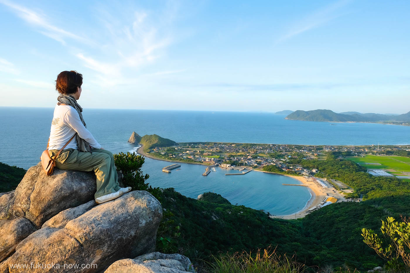
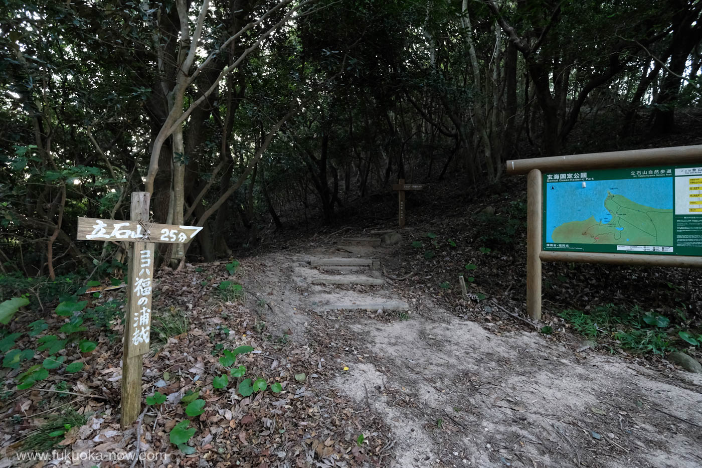
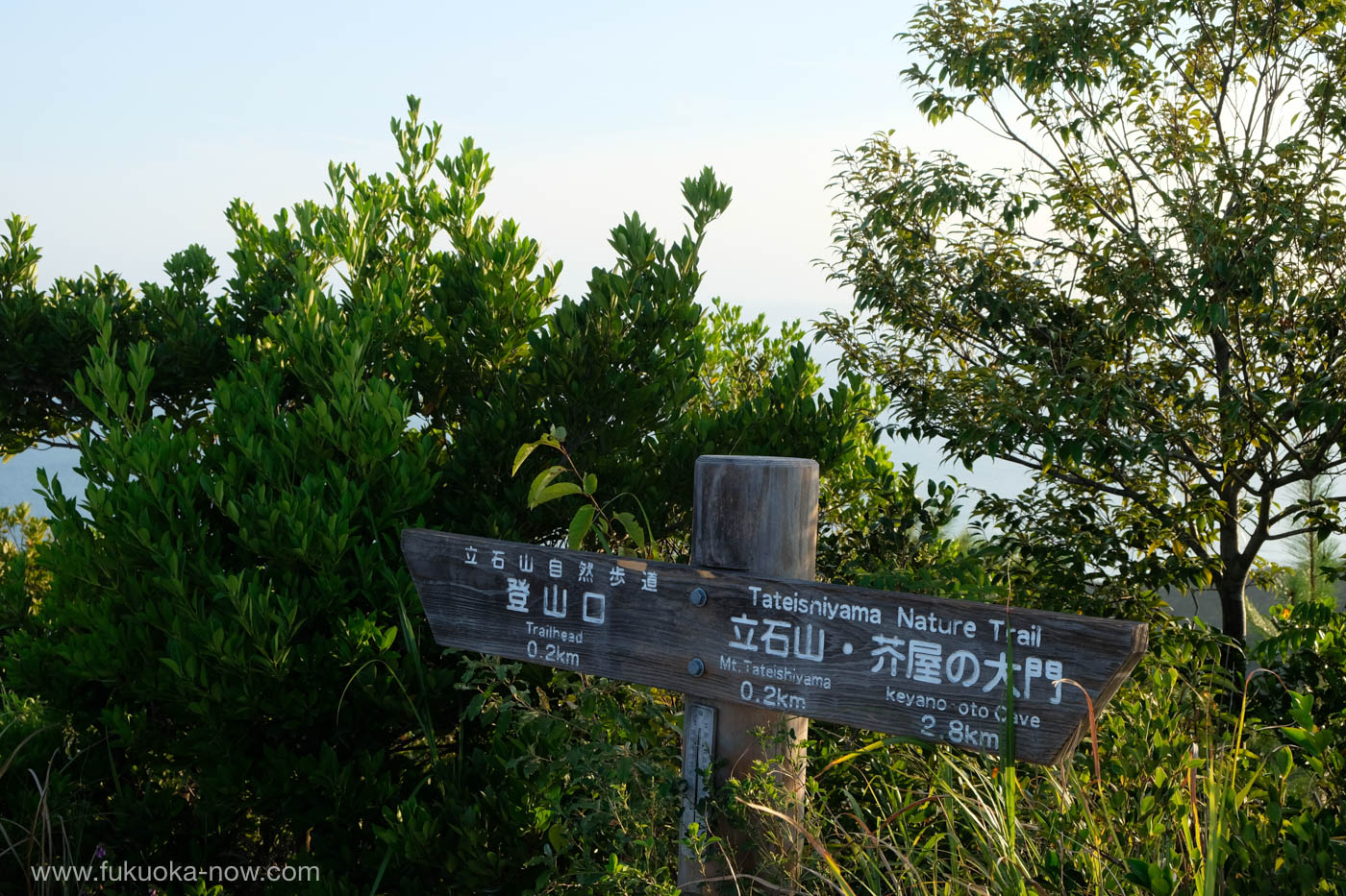
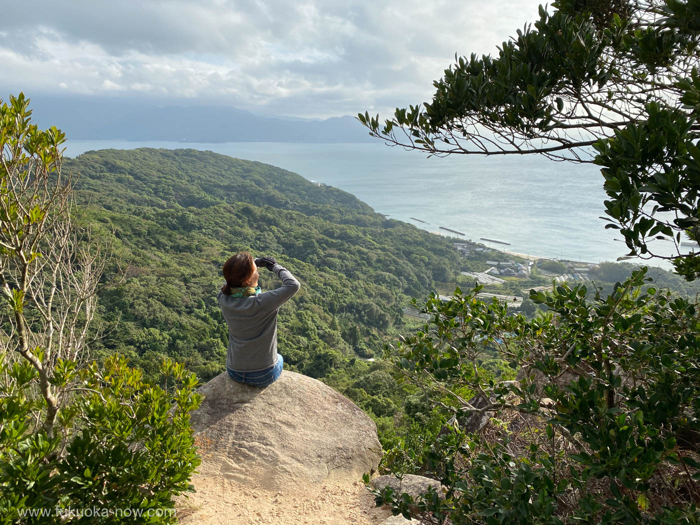
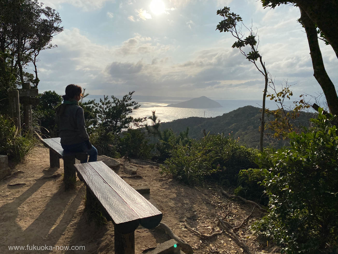
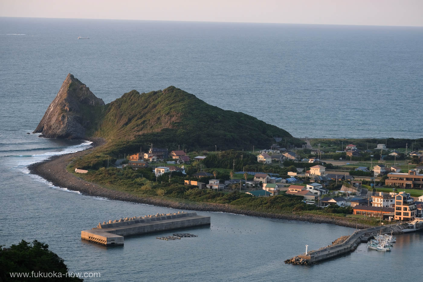
For a spectacular view of the brilliant blue Genkai Sea and the green fields surrounding the rocky outcrop of Keya no Oto, try the hike up Mt. Tateishi. There are two places from which to start, but relax, both climbs are easy peasy and a pair of sturdy sneakers is all you’ll need. From the trailhead at Keya Beach, it’s about 25 minutes to the top. If you have a car, you can start off from the highest point along the mountain road linking Keya to Fukunoura. There’s a telecommunications tower and room for a few cars. From there it’s less than 20 minutes to the summit at 210 m where the view is stunning! If you go, don’t litter and prevent forest fires by not smoking.
Trailhead off Keya Beach, 3793 Shima-keya, Itoshima City
Tateishi Yama
• Address: 3793 Shima-keya, Itoshima City, Fukuoka
• http://www.itoshima-kanko.net/cat/mt-tateishi/
• https://www.city.itoshima.lg.jp/s026/s040/010/010/090/shima_ura_ol.pdf